Categories
Places to Visit

Famous Rivers In And Around Udaipur

The river is everywhere!
Hermann Hesse, Siddhartha

Indeed, rivers are the most beautiful feature of nature created by God. They’re the most celebrated natural thing by poets as they write sonnets on it, personifying them in every possible aspect which expresses beauty or spirituality. Udaipur has been blessed by, not just one, but nine major rivers. Here is a detailed description of all the rivers and their impact on Udaipur city.

YouTube

Banas

Origination– The river originates about 5.5 km from Kumbhalgarh, Rajsamand in the khamnor hills of Aravalli Range. It flows through north-east of Mewar before meeting River Chambal in Sawai Madhopur district of Rajasthan. The basin of the river covers the area of   45,833 square kilometers and is flows up to 512 km.

About– The river has Nathdwara, Tonk and Jahazpur district lying on it, and the river basin covers the districts of Udaipur, Rajsamand, Ajmer, Bundi, Dausa, Tonk, Bhilwara, Chittorgarh, Jaipur, Sirohi, Pali and Sawai Madhopur. The river is under the Bilaspur-Jaipur Project-2009 by Government of Rajasthan and provides drinking water to Jaipur city.

@pinterest

Berach

Origination– The River originates in the north-eastern hills of Udaipur. It serves irrigation purposes and is an important river of the drainage system of the state of Rajasthan. The river flows for 157 km and covers the catchment area of 7,502 square kilometers.

About– The River is the tributary of River Banas. After originating from Udaipur and traveling through for 157 km, it joins Banas in the Bhilwara district of Rajasthan. The river drains the districts of Udaipur, Chittorgarh, Bhilwara, Nimbahera, and Jawad.

@OhMyRajasthan

Ahar

Origination-  The River originates from the hills of Gogunda in the north-west of Udaipur and travels through for 25-30 km before joining the Udai Sagar Lake in the eastern part of Udaipur.

About- The river is the major river flowing through Udaipur. It is joined by numerous tributaries and sub-tributaries. The Ahar River and its tributaries are seasonal in nature and are on the peak of their youth during Monsoons. Ahar River lies at the center and its tributaries form a dendritic pattern. It is sad that the river with rich historical importance is currently the drainage body of the city and is filled with garbage and is extremely polluted and even though the word is everywhere, nothing is in progress to clean and protect it.

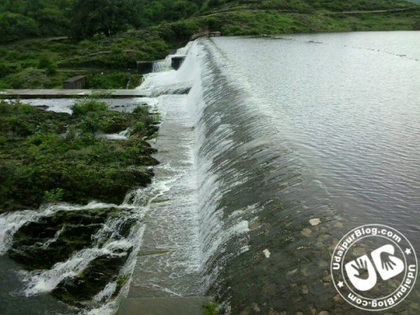
Water gushing in Ayad River towards Lake Udaivilas
Ahad River

Som

OriginationThe River is the tributary of Mahi River, a major west flowing river. Som originates from the hilly region near Som village in the Kherwara tehsil of the Udaipur district and flows for about 156 km in the eastern direction to meet River Mahi. Its catchment area is about 6,443 square kilometers.

About It is elevated up to the height of 600 mts. above sea level. The catchment area is extended over Udaipur and Dungarpur districts of Rajasthan.

@youtube

Gomati

OriginationThe River originates from the central hill of Udaipur district, almost from the Badi Sadri region of Chittorgarh. It ultimately drains to Jaisamand Lake, for the creation of which, it was damned in the 17th century.

AboutThe river is known as the “Ganga of Southern Rajasthan”. It is in a quite dilapidated state currently. 

Gomti River - Wikipedia
@wikipedia

Jakham

Origination- The River originates from the Badi Sadri region of Chittorgarh district and flows south-west through Udaipur district and joins the Som river near the village of   Bilara. It covers a considerable distance and area of 2,318 square kilometers.

About- The river flows towards south-western direction through Udaipur district.   Beneshwar Dham, the holy place situated on the ‘sangam’ of the River Mahi, River Jakham and River Som, is the only place in India where ‘khandit Shivling’ is worshipped.

@panoramio

Sabarmati

Origination- The River originates in the Aravalli hills near Tepur village in Udaipur district. Before reaching Gulf of Cambay in the Arabian Sea, the river travels through for 48 km in Rajasthan and 323 km in Gujrat respectively. It has Banas river Basin towards its east. The total catchment area of the river is 21,674 square kilometers of which 4,124 square kilometers lies in Rajasthan and rest 18,550 square kilometers in Gujarat.

About- There are no culturally important spot or places located on the river in Rajasthan but the river holds quite a religious level in Gujarat. Mythologically, it is said that Lord Shiva brought River Ganga to the state of Gujrat and that is how Sabarmati was born. The river flows through the regions of Pali, Sirohi, Udaipur and Dungarpur districts of Rajasthan.

@ministryofforestandenvironment

Sei

Origination- The River originates from the western projections of the Aravalli hills. It is formed out of smaller rivulets and flows for the distance of 102 km. It covers 946 square kilometers of hilly area and slopes in this 102 km and finally meets River Sabarmati.

About- The river is famous for the Sei Dam which has the water capacity of about 38.6 million-meter cubes. It is a seasonal river.

@Patrika

Wakal

Origination- the River originates from the south-western projections of Aravalli hills and travels for about 88 km before meeting Sabarmati river in the south. The catchment area of the river covers 1,625 square kilometers.

About- The river is the tributary of Sabarmati river and receives an average rainfall of 80 cm during monsoons. The river basin is hilly and covered with forests. It flows through the districts of Udaipur in Rajasthan and Sabarkantha in Gujarat.

@Deserttimes

By respecting and valuing our rivers, it is very necessary that we keep them safe. We must honor the life of rivers and preserve them so that our future generations are able to preserve them as well. We are able to protect the rivers as well which helps in indicating that how valuable the core rivers are to be preserved. Do let us know your reviews on udaipurblog.com.